The industry has spent years framing LiDAR and photogrammetry as competing technologies. For surveyors managing real projects with real deadlines, that framing has always been a distraction. Both data types serve the deliverable. The real question is whether your platform makes you fly twice to get them.
Most survey projects require some combination of a bare-earth surface model, an orthomosaic, and CAD-ready linework. LiDAR handles the first. Photogrammetry handles the second. Linework depends on both. When those datasets come from separate flights, separate sensors, or separate processing pipelines, every handoff introduces time, cost, and alignment risk that lands on the surveyor.
Platforms that capture both simultaneously eliminate that problem entirely, and the operational difference compounds on every project.
READ MORE: What Are the Different Drone Capabilities? LiDAR, Orthoimagery & Linework Explained
The False Choice Between LiDAR and Photogrammetry
Why the "LiDAR vs. Photogrammetry" Debate Misses the Point
Search for drone surveying comparisons, and every result frames the same question: should you use LiDAR or photogrammetry? The articles weigh accuracy against cost, canopy penetration against visual context, and active sensors against passive ones. The conclusion is always some version of "it depends on your project."
That framing made sense when the technologies required entirely different platforms, payloads, and workflows. It made sense when adding a LiDAR sensor meant removing the RGB camera. It made sense when the budget only covered one approach.
For survey firms delivering topographic maps, contour lines, orthomosaics, and linework to engineers and developers, it no longer makes sense. The deliverable requires both datasets. The only question worth asking is how many flights, how many hours, and how many processing steps it takes to get them.
What Engineers Actually Need on Their Desks
A civil engineer reviewing a site plan does not care which sensor technology produced the data. They need a bare-earth surface that is accurate under the canopy. They need an orthomosaic that shows what is actually on the ground. They need contours at a specified interval in state plane coordinates. And they need linework that opens in Civil 3D without a conversion step.
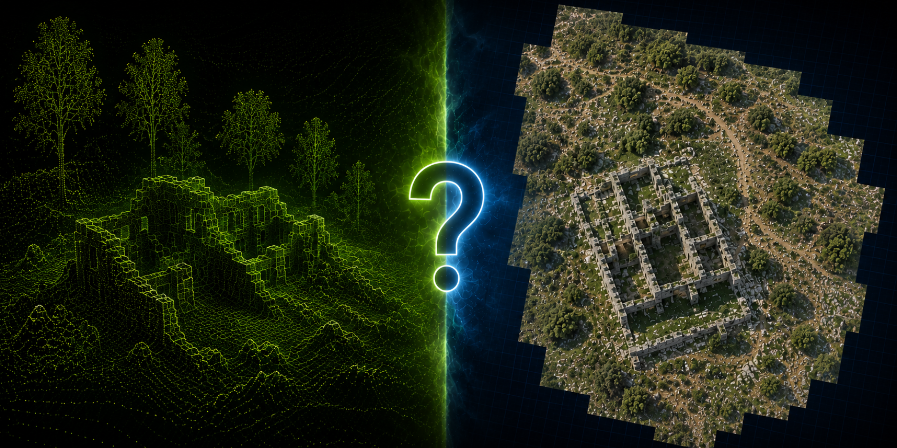
LiDAR produces an accurate ground model. Photogrammetry produces the visual context. Together, they produce the complete deliverable. Separately, they produce two partial datasets that someone has to align, reconcile, and merge — usually under deadline.
What Separate Flights Actually Cost
The Math Nobody Publishes
When a platform requires separate flights for LiDAR and photogrammetry, the cost is not simply "twice the flight time." It is:
- Two flight plans — each requiring airspace coordination, mission setup, and ground control placement optimized for the respective sensor.
- Two sets of batteries — or a charging delay in the field between flights.
- Two processing workflows — often in different software packages, with different coordinate reference handling.
- A registration step — aligning the LiDAR point cloud and the orthomosaic into a single coordinate space, which introduces error every time it is performed manually.
- Extended field time — for a 150-acre site, two separate flights can turn a half-day job into a full day, pushing crew costs and limiting how many projects the team can run per week.
None of these costs appear on a sensor spec sheet. All of them appear in the project margin.
The Sensor Swap Problem
Some platforms attempt to solve this by offering interchangeable payloads — a LiDAR module and an RGB camera that swap onto the same airframe. On paper, this looks like a single-platform solution. In practice, it means landing the drone, powering down, physically swapping the sensor, recalibrating, and launching again.
That swap takes time, introduces a second launch and recovery cycle, and means the two datasets are captured at different times under potentially different lighting and wind conditions. The alignment between them is close but not inherent, because the data was never captured from the same position at the same moment.
An integrated system that captures both datasets simultaneously eliminates every one of those steps.
READ MORE: Comparing Industrial Drones? Don't Just Look at Flight Time
How Simultaneous Capture Changes the Workflow
One Flight, One Dataset, One Coordinate Space
When LiDAR and RGB photogrammetry are captured simultaneously from the same platform in the same flight, the datasets share a single trajectory, a single base station solution, and a single coordinate reference. There is no registration step because there is nothing to register — the data was collected together.
For a 150-acre survey site, that means:
- One flight mission — approximately 39 minutes of flight time, capturing both LiDAR point cloud data and high-resolution RGB imagery.
- ~5.2 million points per second of LiDAR data with simultaneous photogrammetric image capture.
- ~0.15 ft absolute accuracy across both datasets without post-flight alignment.
- A single processing pipeline — one import, one coordinate confirmation, one output.
The field crew flies once, validates the data once, and packs out. The office processes one unified dataset. The engineer receives deliverables that were never stitched together from separate sources.
What This Means for Acreage Per Day
Survey firms measure productivity in acreage per day, not flight time per mission. A platform that captures both data types in a single flight does not just save time on that flight — it frees the crew to move to the next site.
An operation running separate LiDAR and photogrammetry flights on a 150-acre parcel might complete one site per day. An integrated platform covering the same acreage in a single 39-minute flight can realistically complete two or three sites in the same window. Over a full project season, that difference compounds into a significant revenue and capacity advantage.
Where Each Technology Still Has an Individual Role
When LiDAR Matters Most
LiDAR earns its place on projects where the ground surface is not visible from above. Dense tree canopy, heavy brush, and mixed vegetation create conditions where photogrammetry alone cannot produce an accurate bare-earth model. The laser pulses penetrate gaps in the canopy and return measurements from the ground surface beneath it.
For topographic surveys in wooded areas, environmental corridor mapping, and any project where the client needs contours under tree cover, LiDAR is not optional — it is the only path to an accurate ground surface.
When Photogrammetry Matters Most
Photogrammetry provides visual context that LiDAR does not. An orthomosaic shows exactly what is on the ground — structures, pavement edges, drainage features, vegetation boundaries, and existing improvements. Engineers and planners use orthomosaics for site context, progress documentation, and planimetric feature identification.
On cleared or lightly vegetated sites, photogrammetry can also produce accurate surface models at a lower processing cost. For projects where canopy penetration is not required, the visual data alone may satisfy the deliverable.
Why the Integrated Approach Wins on Most Survey Projects
The reality for most land survey projects is that both conditions exist on the same site. A 500-acre development parcel may have cleared pads, dense tree lines along creek corridors, scattered brush, and paved roads. LiDAR handles the vegetated areas. Photogrammetry handles the visual documentation. Together, they produce the contours, orthomosaic, and linework the engineer needs — from a single flight, without compromise on either dataset.
When the platform forces a choice between them, the surveyor either delivers an incomplete dataset or doubles the field time. Neither outcome serves the client or the firm.
READ MORE: What is Drone Surveying & How Does It Compare to Traditional Land Surveying?
What to Evaluate Before You Buy
Questions That Separate Integrated Systems from Bolt-On Solutions
Not every platform that claims to offer LiDAR and photogrammetry delivers both simultaneously. Before committing, the following questions separate genuinely integrated systems from hardware that simply carries two sensors:
- Are both sensors capturing data simultaneously during flight, or does the platform require sequential collection? Simultaneous capture produces inherently aligned datasets. Sequential capture produces two datasets that require post-processing alignment.
- Is the payload enclosed and integrated, or are the sensors mounted externally and interchangeable? Enclosed, integrated payloads are calibrated together and maintain alignment across flights. External mounts introduce variability.
- Does the processing software handle both data types in a single pipeline? If LiDAR and photogrammetry outputs require separate software packages, the integration stops at the hardware level and the coordination overhead lands on the operator.
- Can the crew verify data completeness for both datasets before leaving the field? A field verification tool that checks LiDAR coverage, RGB image quality, and base station performance in one review prevents return trips that erode the time savings.
- What is the actual acreage per flight with both sensors active? Some platforms sacrifice coverage area when running dual sensors. A system designed around simultaneous capture maintains full performance with both active.
Why NDAA Compliance Matters for This Decision
For survey firms working on government-funded infrastructure, transportation, or environmental projects, the platform must also meet NDAA compliance requirements. An integrated, American-made system that captures both LiDAR and photogrammetry in a single flight simplifies the compliance conversation entirely — one platform, one supply chain review, one procurement approval.
The Operational Advantage Compounds Over Time
The firms that will run the most efficient drone survey operations over the next several years will not be the ones with the most expensive sensors or the longest flight times. They will be the ones who eliminated unnecessary steps from the workflow early.
Flying twice to collect data that could have been captured once is an unnecessary step. Swapping sensors in the field is an unnecessary step. Aligning datasets from separate flights in the office is an unnecessary step. Each one adds time, cost, and error — not on one project, but on every project.
An integrated platform that captures LiDAR and photogrammetry simultaneously removes all three. The time savings on a single project may feel modest. Across a full season of projects, it is the difference between a firm that is always behind schedule and one that consistently delivers ahead of schedule.
Evaluating an integrated drone mapping platform for your survey operation? Contact SmartDrone to see how Magellan captures LiDAR and photogrammetry in a single flight — and what that means for your acreage per day.